DsJeffries was there, and I'm sure he can provide a much better summary than this. (Go DSJ!) But it was a ton of fun, and I think every group came in well under budget.
Ponder did a great job of recounting the workshop... I'd like to talk a little about my group's map was different than most plans that were presented.
As Ponder mentioned, most groups focused one rail. Most provided
commuter rail from downtown to the Broken Arrow border via the Broken Arrow Expressway. Our group bucked the trend and instead focused on
light rail.
We did this for several reasons:
1) This is Tulsa's plan, not Broken Arrow's (or Owasso's or Jenks's). Though rail can create synergy between our metro communities and can spur growth, not all rail is created equal, and shouldn't be treated as such. Therefore, in the beginnings of a rail transportation system, we need to focus on our community rather than the suburbs.
1a)Convenient commuter rail, much like convenient 6-lane highways, gives people one more reason
not to live within or near the city's core. It provides them with a quick way in and a quick way out, and actually allows for more development to continue at the city's fringe instead of the heart of the city. As such, it would mainly serve the dayworkers from Broken Arrow instead of the citizens of Tulsa.
We wanted to draw people
IN to the city, not give them another option to build developments as far away from the core as possible.
We traded all of our commuter rail stickers that would have been dedicated only to a Tulsa-BA route for light rail stickers and were able to give several options to different areas of the city:
Light rail stations are much closer together (1 mile) than commuter rail stations (2-5 miles), and would allow for much more Transit-Oriented Development (TOD) within Tulsa than commuter rail. Since stations are closer together, it would also make it for convenient for people to actually catch a ride.
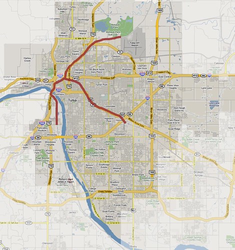
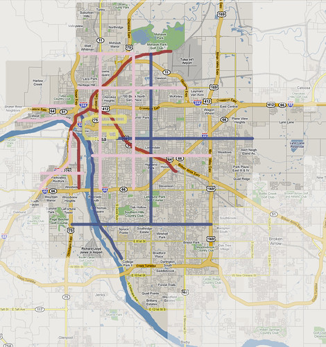
There was a
Downtown-Airport Route with possible future extensions to Owasso, serving downtown, Evans-Fintube and OSU, North Tulsa, TCC Northeast, the Zoo and Mohawk Park, and the airport.
There was a
West Bank Route with possible future extensions to Jenks, serving as a catalyst to West Tulsa redevelopment in key areas such as 23rd & Jackson, terminating at 41st Street.
Finally, there was the
Midtown Route which followed the Broken Arrow Expressway and terminating at the industrial sites east of the BA-I 44 interchange. Its terminus, we felt, was a great location for Transit-Oriented Development since industrial sites are the easiest to convert and redevelop. It would also serve as a gateway for a future extension to Broken Arrow.
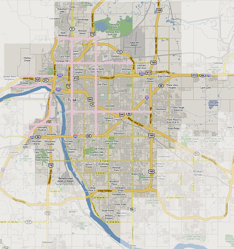
In addition to light rail, we developed a
trolley system connecting downtown nearby destinations:
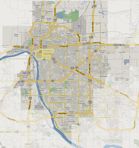 The TU Loop
 extends from downtown via 6th and 11th Streets, and could help play a role in redeveloping
the Mother Road.
Cherry Street-Utica Loop, extending down 15th Street to Lewis, south to 21st Street to service St. John and Utica Square, and north up Utica.
The Central Loop follows 6th Street to Peoria, south to 21st Street, west to Denver and back north, terminating in the Brady District.
Throughout the TU Loop, we placed several Transit-Oriented Development stickers.
Linking all of these transit options together were two different types of bus lines,
Bus Rapid Transit and
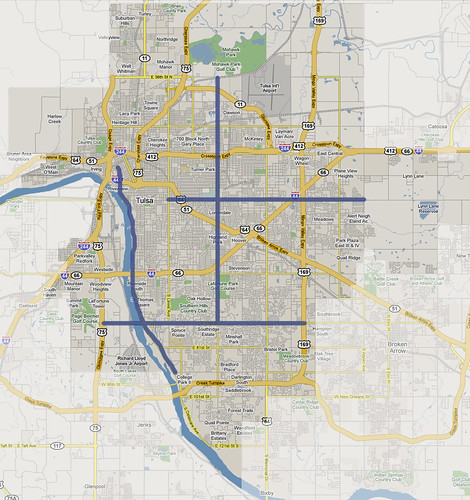
Express Bus. (Only BRT shown here)
The BRT system runs the length of 71st Street between Highway 169 and Highway 75; a Riverside Line from downtown to around 91st Street; a Central Corridor (Yale Avenue) line, connecting all points between Mohawk Park and 71st Street (serving St Francis Hospital, higher-density employment areas, Promenade Mall, the Fairgrounds, the Airport and the Zoo) and which also intersects both the Midtown and Airport Light Rail lines, providing opportunities for Transit-Oriented Development; and another critical east-west route along 21st Street terminating at Eastgate Metroplex and intersecting the Midtown Light Rail line.
We also used Express Bus lines, Multi-use path and Multi-modal street design. (Multi-modal shown here)
Multi-modal street design is a great way to reinvent a street, emphasizing bicycle, pedestrian and transit infrastructure, and focused more on
just moving automobiles. Areas we identified that could benefit from this include:
-Harvard, between 36th Street North and 51st Street
-Peoria, between 36th Street North and 51st Street
-36th Street North, between the LL Tisdale Expressway and Harvard
-Charles Page Boulevard
-Southwest Boulevard
-31st Street
-West 41st Street
This map shows how all of these elements came together in a way that would allow people from all parts of the city access to multiple modes of transportation:
It also allows for easy extensions of the system in the future:
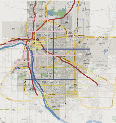
This map is incomplete, as I haven't added in the express bus, multi-use path or transit-oriented development sites we chose, but I'll complete it within the next few days.


