|
Townsend
|
 |
« on: March 04, 2014, 03:35:40 pm » |
|
INCOG Starts Taking Public Input for Regional Cyclist and Pedestrian Planhttp://kwgs.com/post/incog-starts-taking-public-input-regional-cyclist-and-pedestrian-plan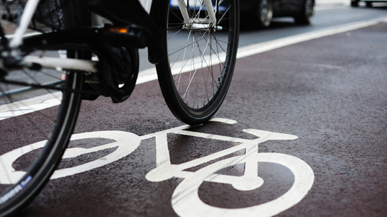 INCOG holds the first public meeting on its regional master plan for bicycle- and pedestrian-friendly development today at 5:30 p.m. at the TCC Center for Creativity, 910 S Boston Ave.
About 80 percent of Tulsans live within 2.5 miles of a paved trail, and James Wagner, INCOG's transportation projects coordinator, said theyre looking at the regions 114 total miles much like a highway for the GO Plan.
"It's separated. You don't have to cross very many paths with vehicles, just like the highway network for cars," Wagner said. "And so if you think of it that way, what we haven't done is we haven't built the on-ramp system, so to speak, to get to that trail system from the neighborhoods, or you might think of it as the arterial system to get to it."
The company working with INCOG on the plan has an innovative way for the public to contribute.
The region has nearly five times as many miles of paved trail today as it did 15 years ago. Now the goal is making it easier and safer for more people to get to them. Katie Mencarini with Toole Design Group said people of all athletic abilities can help guide the GO Plan using an online Wiki map.
"So maybe there's a crossing that's really challenging, or maybe there's a route that they like to take but it could be improved," Mencarini said. "It allows them to draw it on a map, and we can just transfer it to another map without trying to guess where they're talking about and assume that we understand the right location."
A draft of the plan could be done by the end of the year. Feedback on the plan and the Wiki map are available at the GO Plan website.
|
|
|
|
|
 Logged
|
|
|
|
|
RecycleMichael
|
|
« Reply #1 on: March 04, 2014, 04:05:32 pm » |
|
We should all drive in separate cars to get there tonight.
|
|
|
|
|
Logged
|
Power is nothing till you use it.
|
|
|
|
davideinstein
Guest
|
|
« Reply #2 on: March 04, 2014, 04:20:01 pm » |
|
We should all drive in separate cars to get there tonight.
Or walk four blocks from work. See you guys there. |
|
|
|
|
Logged
|
|
|
|
|
davideinstein
Guest
|
|
« Reply #3 on: March 04, 2014, 07:03:59 pm » |
|
Decent meeting. I don't have a lot of faith much will change. But he did say some of their recommendations will be aggressive. I'll be involved because I'm a fan of the mission, but I'm apathetic we can become a progressive city with our infrastructure.
|
|
|
|
|
Logged
|
|
|
|
|
Conan71
|
|
« Reply #4 on: March 04, 2014, 08:53:50 pm » |
|
David, when you get a chance, can you at least summarize what all was proposed?
I had other obligations I couldn't change on such short notice.
|
|
|
|
|
Logged
|
"It has been said that politics is the second oldest profession. I have learned that it bears a striking resemblance to the first -Ronald Reagan
|
|
|
|
sgrizzle
|
|
« Reply #5 on: March 05, 2014, 08:11:03 am » |
|
Decent meeting. I don't have a lot of faith much will change. But he did say some of their recommendations will be aggressive. I'll be involved because I'm a fan of the mission, but I'm apathetic we can become a progressive city with our infrastructure.
Keep in mind there are capital funds dedicated to this program |
|
|
|
|
Logged
|
|
|
|
|
Townsend
|
|
« Reply #6 on: March 05, 2014, 09:08:36 am » |
|
Keep in mind there are capital funds dedicated to this program
Can they be re-directed? |
|
|
|
|
Logged
|
|
|
|
|
|
|
davideinstein
Guest
|
|
« Reply #8 on: March 05, 2014, 03:55:57 pm » |
|
David, when you get a chance, can you at least summarize what all was proposed?
I had other obligations I couldn't change on such short notice.
The first segment was about health in the region and how unhealthy we are. The second segment was explaining the process they will use to recommend a plan using data, field assessments and plans from other areas of the country/world. The last segment dealt with some basic questions from the audience. Very, very basic presentation since they don't have a plan to present yet. Looking forward to that meeting in the future. |
|
|
|
|
Logged
|
|
|
|
|
SXSW
|
|
« Reply #9 on: March 06, 2014, 01:03:54 pm » |
|
The river trails are a huge asset. Not many other cities have anything similar in such a central location and very few have anything as nice as the dual trails from 11th to 71st. I would hope the revised plan includes an expansion of the river and adjacent trails in the following areas:
Short-range
- Dual jog/bike trail extension from 71st to the Creek Turnpike trail. I know the Creeks are doing part of this but not sure if they are doing a single trail or dual through their property.
- Single trail extension from Turkey Mtn to the Jenks river trails finishing the loop
- Crow Creek trail from the river to Zink Park including underpasses at Riverside and Peoria
- Fred Creek trail from the river to ORU campus and surrounding neighborhood including underpasses at Riverside, 81st and Lewis
- Single trail from the Creek Turnpike along the river to the Memorial bridge/Washington Irving Park in Bixby
Long-range
- Single trail extension from 11th to Hwy 97 bridge in Sand Springs on the north and south banks. Include a pedestrian bridge component in between with the proposed low water dam
- Trail along the Gilcrease Expressway connecting the river trail to the MV trail
- Trail from the river to Lafortune Park along Joe Creek including underpasses at Riverside, 71st, 61st, Lewis, Harvard and Yale
|
|
|
|
|
Logged
|
|
|
|
|
rebound
|
|
« Reply #10 on: March 06, 2014, 01:48:08 pm » |
|
I add one more short term: A dedicated multi-use trail, instead of the existing bikeway, along Mohawk blvd to Mohawk park.
|
|
|
|
|
Logged
|
|
|
|
|
Conan71
|
|
« Reply #11 on: March 06, 2014, 02:06:43 pm » |
|
The river trails are a huge asset. Not many other cities have anything similar in such a central location and very few have anything as nice as the dual trails from 11th to 71st. I would hope the revised plan includes an expansion of the river and adjacent trails in the following areas:
Short-range
- Dual jog/bike trail extension from 71st to the Creek Turnpike trail. I know the Creeks are doing part of this but not sure if they are doing a single trail or dual through their property.
- Single trail extension from Turkey Mtn to the Jenks river trails finishing the loop
- Crow Creek trail from the river to Zink Park including underpasses at Riverside and Peoria
- Fred Creek trail from the river to ORU campus and surrounding neighborhood including underpasses at Riverside, 81st and Lewis
- Single trail from the Creek Turnpike along the river to the Memorial bridge/Washington Irving Park in Bixby
Long-range
- Single trail extension from 11th to Hwy 97 bridge in Sand Springs on the north and south banks. Include a pedestrian bridge component in between with the proposed low water dam
- Trail along the Gilcrease Expressway connecting the river trail to the MV trail
- Trail from the river to Lafortune Park along Joe Creek including underpasses at Riverside, 71st, 61st, Lewis, Harvard and Yale
Since you are in construction, I figured you might have an idea on this. Would pedestrian fly-overs like the one at 56th & Harvard, rather than underpasses, be less expensive to construct? They certainly would mean less disruption to traffic on arterial streets while under construction. They really need to figure out something, one way or the other, at Sheridan on the Creek Trail, thats an accident waiting to happen. The Mingo, Garnett, and 111th St. crossings are not much better either. |
|
|
|
|
Logged
|
"It has been said that politics is the second oldest profession. I have learned that it bears a striking resemblance to the first -Ronald Reagan
|
|
|
|
TeeDub
Guest
|
|
« Reply #12 on: March 07, 2014, 08:58:05 pm » |
|
Would pedestrian fly-overs like the one at 56th & Harvard, rather than underpasses, be less expensive to construct?
They definitely feel safer at night than dark underground tunnels. |
|
|
|
|
Logged
|
|
|
|
|


